Welcome to UAS Aerial Survey
Aerial lidar survey, Photography, thermal imagery and Inspections.
We offer a wide range of aerial inspection and survey services, utilizing the latest drone technology. Our team of qualified and licensed UAS drone pilots are experts in capturing high-quality aerial photos and videos for various industries. Whether it's a lidar survey , 3D photogrammetry ,volumetrics ,aerial inspections, thermal imaging inspections, or historic building aerial inspections, we have the expertise and equipment to deliver exceptional results.
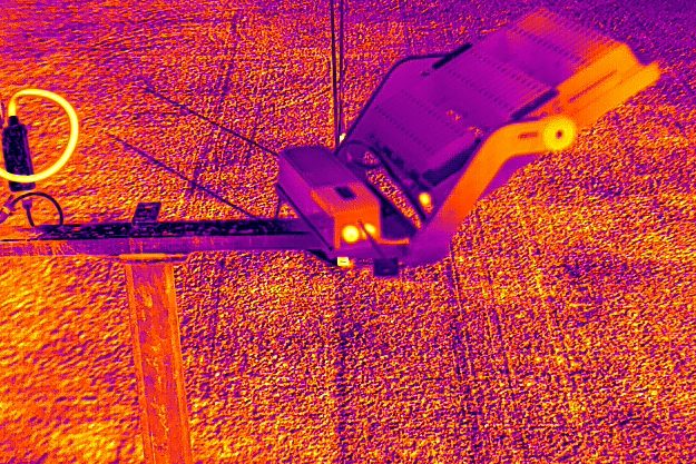
Aerial and thermal imagery Inspections
Our high-resolution cameras can provide accurate and detailed aerial inspections of various structures and properties. From roof inspections { air leaks, water ingress points, heat loss } to infrastructure assessments { pylons,bridges,historic structures } our thermal camaras can provide easy to view images of temperature differences of mechanical or electrical equipment solar farms wind turbines and deliver inspection reports.
- Agriculture
- Forestry
- Archaeology
- Flood management
- Construction
- Building preservation
- Wildfire management
- Solar panel inspections
- solar farms
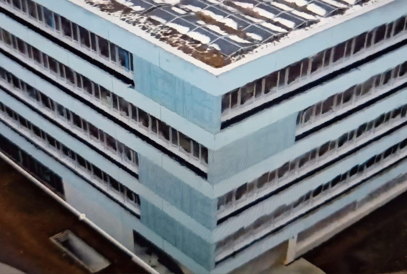
2D/3D SURVEY
3D photogrammetry allows the user enhanced visualisation of a project, with a digital representation of the real world but with a higher degree of detail and efficient data collection leading to improved accuracy and better planning, the detail is so precise you literally walk around a building or project .
- Architecture
- Engineering
- Archaeology
- Urban planning
- Real estate professionals
- Geology
- Mining and aggregates
- Waste management
- Coastal and river erosion
- Horticulture
- Landscaping

LIDAR SURVEY
Lidar survey allows you to view highly detailed imagery of terrain, it is a fast and cost-effective method with high accuracy even if the terrain is covered in heavy vegetation , lidar can achieve centimetre level accuracy making its surveys valuable for many various applications.
- Town planning
- Flood mapping and monitoring
- Agriculture
- Forestry
- River and canal survey
- Coastal erosion
- Conservations
- Disaster planning
- Shoreline mapping
- Survey for small or large building projects.
About Us
Delivering High-Quality Aerial Solutions
At UAS Aerial Survey, we pride ourselves in providing top-notch aerial photography and inspection services. With years of experience in the industry, we have established ourselves as a trusted name in delivering accurate and detailed aerial surveys. Our team is composed of qualified and licensed UAS drone pilots who adhere to strict safety and professional standards. contact us to discuss how we can assist you in your project.